

By Zach Friend, Supervisor, Second District
Editor’s Note: California Sens. Dianne Feinstein and Alex Padilla, and Reps. Jimmy Panetta and Zoe Lofgren have written to the U.S. Army Corps of Engineers asking the agency to speed up engineering reviews for rebuilding the Pajaro River levee, which has been scheduled to begin in 2025, and provide funds for emergency rehab to meet higher standards.
What is the levee history?
The existing levees that protect the communities were built in 1949 and have not since been significantly improved.
Soon after construction, Watsonville and Pajaro sustained serious flood damage in 1955 and in 1966 it was determined by the federal government that it was necessary to rebuild the levees. In essence, the federal government acknowledged that the levees that they built in the late 1940s were undersized and inadequate to meet the need for flood protection.
Today, these levees provide only an average of 8-year level of flood protection, believed to provide the lowest of any federal flood control system in California and one of the lowest in the United States.
Why hasn’t the levee rebuilding been funded by the federal government?
Over the last 50-plus years there have been significant attempts to secure funding for a levee rebuild. While there are multiple factors that can delay a levee rebuild (including design issues, and environmental issues) the key underlying issue that has disadvantaged this project (and many other projects across the country in low-income communities) for funding is in how federal flood control projects calculate what they call the BCR — benefit-cost-ratio.
The challenge here is self-evident – that in lower-income communities (where property values may be less expensive than in a more urban affluent community) the benefit calculation will be lower.
Additionally, many rural and agricultural communities are further constrained by how agricultural land is valued (in some cases it’s valued at zero) in these federal calculations. Given that much of the area is rural, low-income and agriculturally-based, our area always scored very low on the benefit-cost ratio.
We are not alone in this and many rural and federally-disadvantaged communities across the country have experienced significant delays in receiving funding or having their projects deemed “feasible” by these antiquated federal measures.
What is the proposed project?
The federal flood management project, sponsored by the U.S. Army Corps of Engineers, is designed to provide a 100-year flood protection to Watsonville and Pajaro and and a mix of 100-year and 25-year flood protection to some of the other surrounding agricultural areas in Santa Cruz and Monterey counties).
Per capita income in these communities is less than half the state and national averages.
This project will provide significant life and economic safety improvements to both counties and even eliminate flood insurance costs for those within the FEMA Special Flood Hazard Area.
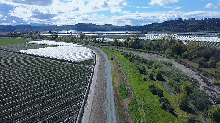
The project is expected to start on Reach 6 — which is along Corralitos Creek (where significant flooding has occurred this winter). A map for the project can be found at this link: https://www.prfma.org/risk-management by clicking on “Project Fact Sheet.”
What is the project cost?
The $400+ million project will include construction of levees and improvements, to include setback levees, along the lower Pajaro River and its tributaries.
It will be managed by the U.S. Army Corps of Engineers in partnership with the Pajaro Regional Flood Management Agency and the CA Department of Water Resources.
How will the project be funded?
Funding such a costly project has been one of the largest challenges because of the benefit-cost ratio issues outlined above. However, in the last few years we have received historic investments from the state and federal level — and a local assessment that covers ongoing operations and maintenance.
These federal projects have cost-share requirements with local communities — in this case the federal government would pay 65 percent and the local community 35 percent. The State of California agreed to fund 100 percent of the local cost share — up to $181 million of project costs.
According to conversations with the Army Corps and White House, our community is the only in the country to have the state commit to such funding.
Additionally, the White House announced they have set aside nearly $70 million in federal funding into the project as part of the Administration’s infrastructure funding that they are focusing on environmental and social justice projects —which allowed our community (which has historically been unable to receive funding due to our low scoring benefit-cost ratio to have a chance to compete.
Approximately $5 million in additional funding has already been provided by the Army Corps as part of the planning and design process.
Additional federal funding is expected as the phases of the project are built — equating to the 65 percent total federal cost share. The local ongoing operations and maintenance ($1.2 million) will be raised through the recently-approved assessment.
What is the status of the project?
Work has begun in earnest to set the stage for levee reconstruction. The Army Corps and local sponsors have begun the pre-construction engineering and design phase. The Corps started initial work that will support design sections along the Corralitos and Salsipuedes Creek corridor. The Army Corps awarded a contract to an engineering firm to develop the designs and specifications for the flood control facilities to be built along this portion of the project.
Initial work in support of design includes geotechnical subsurface investigation and subsurface data collection. This work began in late spring last year — which included collecting nearly 200 rights-of-entry throughout the project footprint along the Corralitos and Salsipuedes Creek corridor.
A secondary contract was awarded by the Corps to conduct topographic surveying within these areas in support of design. Cultural and environmental survey work will begin this summer to support project design and State Historic Preservation Office and Tribal coordination requirements, and to update the Project’s Programmatic Agreement.
Every effort is being made by our regional advocates as well as our state and federal delegation to expedite the rebuild process — a lot of the timeline for construction surrounds completion of state and federal environmental review and other required regulatory requirements and we are working with those partners to streamline those to move up the construction timeline.
How can you learn more about the project and how can you volunteer with cleanup efforts?
If you are interested in learning more about the project in general, you can check out the PRFMA website at www.prfma.org — or you can always contact me below.
If you would like to help out flood victims in Pajaro with cleanup efforts, the Volunteer Center of Santa Cruz County is organizing efforts via this link: www.scvolunteernow.org/flood
•••
As always, I appreciate any feedback you may have on this (or any other County issue). I’m maintaining regular updates on social media at www.facebook.com/supervisorfriend and you can always call me at 454-2200.