By the San Lorenzo Valley Water District
With the rainy season behind us, the focus of San Lorenzo Valley Water District is now on future groundwater levels as the drier summer months approach.
 Groundwater is the primary source of drinking water for district customers from June through October when surface water flow is low during drier months. Rainfall is the main source of recharge to the basin and surface water flows.
The groundwater basin is shared by the San Lorenzo Valley Water District, Scotts Valley Water District and Mount Hermon Association, as well as local businesses and residents using private wells.
The Santa Margarita Groundwater Agency at its Board of Directors meeting in April held an informational session that centered on groundwater levels and the agency’s goals for future groundwater levels.
The San Lorenzo Valley Water District is one of three member-agencies that make up the agency, along with the Scotts Valley Water District and the County of Santa Cruz.
 The session examined groundwater in the Santa Margarita Basin and its four primary aquifers: Santa Margarita aquifer, Monterey formation, Lompico aquifer and Butano aquifer. The session identified the unique characteristics of each aquifer and its particular set of users.
- The aquifer closest to the surface is the Santa Margarita. It is about 100 feet thick, on average, and is the most vulnerable to fluctuations in climate conditions. That means it recharges the fastest during periods of rainfall, but also depletes the most quickly during dry times or when lots of pumping occurs. The District and most private well owners draw water from this aquifer.
- The next aquifer down is the Monterey formation, which is not a true aquifer and a very few wells pump from it. It is a clay layer found in limited areas of the basin.
- The third layer down, the Lompico aquifer, is a main source of supply for local water districts. It is generally found around depths of 500-700 feet below the surface.
- Finally, the Butano aquifer is deepest and occurs at around 1,000 feet below the surface of the valley floor. Currently, only the Scotts Valley Water District extracts water from this aquifer.
The groundwater aquifers aren’t evenly deposited throughout the basin, according to Georgina King of Montgomery & Associates, who gave the April presentation. Rather, the underground bowl-shaped basin supports varying levels and depths of each aquifer in different areas. The deeper layers are exposed to the land surface in the upgradient of hillsides, which are the principal recharge zone for these aquifers.
Evaluating groundwater levels is one of the state-required elements of the Sustainable Management Criteria in the Groundwater Sustainability Plan. The Santa Margarita Groundwater Agency board must set minimum thresholds for groundwater levels in the basin as well as measurable objectives to ensure the basin’s sustainability. The board provided input on the significant and unreasonable conditions that will be used to develop a draft qualitative statement for board review.
The Santa Margarita board meeting on April 23 was conducted via all-remote, web- and phone-based access due to the Santa Cruz County Shelter-in-Place Order response to the coronavirus outbreak. The agenda allowed time for public comment and participation on each agenda item.
If you are interested in learning more about the SMGWA or the District’s involvement visit https://smgwa.org/. The agenda for the next SMGWA Board of Directors meeting and any supplementary materials will be made available https://smgwa.org/ as they are generated by staff. Due to the circumstances regarding the ongoing shelter-in-place orders, all agency meetings will be held in a remote-access format until further notice.
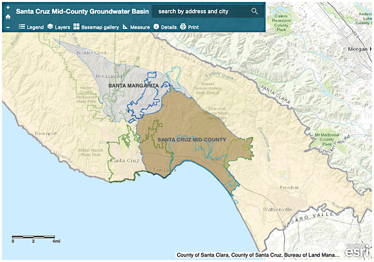
Map: http://www.midcountygroundwater.org/mid-county-basin-area/interactive-map
